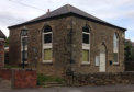
About Cutthorpe and its History
Cutthorpe
Village
Derbyshire
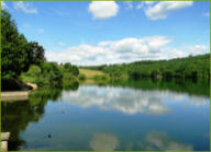
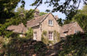
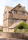
Cutthorpe stretches for 3 miles and rises from 115 to 300 metres from Four Lane Ends to the top of Grange Hill. It is part
of the parish of Brampton and has many lovely houses both new including two historic halls - The Old Manor House, once
the property of the Sitwell family, built in 1625 by Robert Clarke, the first Mayor of Chesterfield, and Cutthorpe Hall c1675
is a former residence of the Heathcote family.
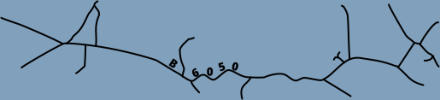
This interactive map has pop-ups (click on the numbers) with information about points of interest throughout the village. A
printable version can be found below.
Thanks to Christine Gaskin who created the original version of this map and for her permission to use it here.
Further reading
A History of Cutthorpe Village by Judith Stubbs (no longer in print but can still be found in the library) Part 1 Portrait of a Schoolmaster, Part 2 Tudor Foundations, Part 3 Besoms, Baskets and Black Gold


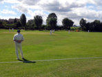
Recreation
Ground

Ingmanthorpe
Wood
Linacre Reservoirs
Pratthall
School
Barlow
Grange
Grange
Hill
Birley
To Baslow
To Barlow
Overgreen

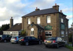
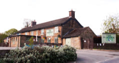
The Gate Inn
Riggots
Way
Common
Lane
To Barlow

Four Lane
Ends
The
Granary
Cutthorpe
Green
Bridleway


Visitor
Centre
(Public Toilets)


To Old Brampton

Linacre Brook


To
Holmebrook
Valley Park
(Cafe and Public Toilets)
Upper
Newbold


Oxton
Rakes
The Three
Merry Lads


Pub
Public Highway
Footpath


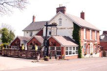
The Peacock
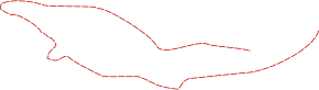
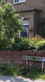
House Names and Numbers for Main Road, Cutthorpe
Many of the houses in Cutthorpe only have a name and not a number - confusing for visitors and deliverymen alike!
Pete Stott has stepped up to the mark and put together a map with the house names on - so if you have a query you can
check here. Copies of this map are also placed in the Book Swap Phone Box
Many thanks to Pete for services to the village.


About Cutthorpe
Cutthorpe
Village
Derbyshire
House Names and Numbers for Main Road, Cutthorpe
Many of the houses in Cutthorpe only have a name
and not a number - confusing for visitors and
deliverymen alike!
Pete Stott has stepped up to the mark and put
together a map with the house names on - so if you
have a query check here. Copies of this map are also
placed in the village Book Swap Phone Box
Many thanks to Pete for services to the village.
Cutthorpe stretches for 3 miles and rises from 115 to
300 metres from Four Lane Ends to the top of Grange
Hill. It is part of the parish of Brampton and has many
lovely houses both new including two historic halls -
The Old Manor House, once the property of the Sitwell
family, built in 1625 by Robert Clarke, the first Mayor
of Chesterfield, and Cutthorpe Hall c1675 is a former
residence of the Heathcote family.
This interactive map has pop-ups (click on the
numbers) with information about points of interest
throughout the village. A printable version can be
found below.
Thanks to Christine Gaskin who created the original
version of this map and for her permission to use it
here.
About Cutthorpe and its History


Recreation
Ground

Ingmanthorpe
Wood
Linacre Reservoirs
Pratthall
School
Barlow
Grange
Grange
Hill
Birley
To Baslow
To Barlow
Overgreen

The Gate Inn
Riggots
Way
Common
Lane
To Barlow

Four Lane
Ends
The
Granary
Cutthorpe
Green
Bridleway


Visitor
Centre
(Public Toilets)


To Old Brampton

Linacre Brook


To
Holmebrook
Valley Park
(Cafe and Public Toilets)
Upper
Newbold


Oxton
Rakes
The Three
Merry Lads


Pub
Public Highway
Footpath


The Peacock
Further reading
A History of Cutthorpe Village by Judith Stubbs (no longer in print but can still be found in the library) Part 1 Portrait of a Schoolmaster, Part 2 Tudor Foundations, Part 3 Besoms, Baskets and Black Gold

